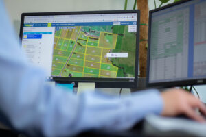
Farm mapping with Tabula, based off Google Earth satellite imagery is used by Gippsland Bulk Spreaders for enabling spread maps to be sent directly to spreader trucks, this increases efficiency as we know the area for spreading and our customers can continue to remain productive, rather than needing to guide our trucks to the correct areas for spread.
Gippsland Bulk Spreaders can provide product placement maps and keep a record of nutrient applied by our spreader trucks and tractor to provide to our customers when needed. We know how important good quality farm maps are for farming operations, so Gippsland Bulk Spreaders can provide farm maps to customers to use in their own farm planning.